EnviroInsite does allow for the display of MrSID images. The code that processes those images is facilitated by public-domain libraries provided by Celartem, Inc. dba LizardTech. Since MrSID files are routinely greater than one gigabyte, EnviroInsite extracts a user-specified portion of the MrSID image to process to user specifications and writes out an image file in a common format specified by the user. That file is automatically georeferenced and inserted in the EnviroInsite view.
View a training video on importing MrSID images here.
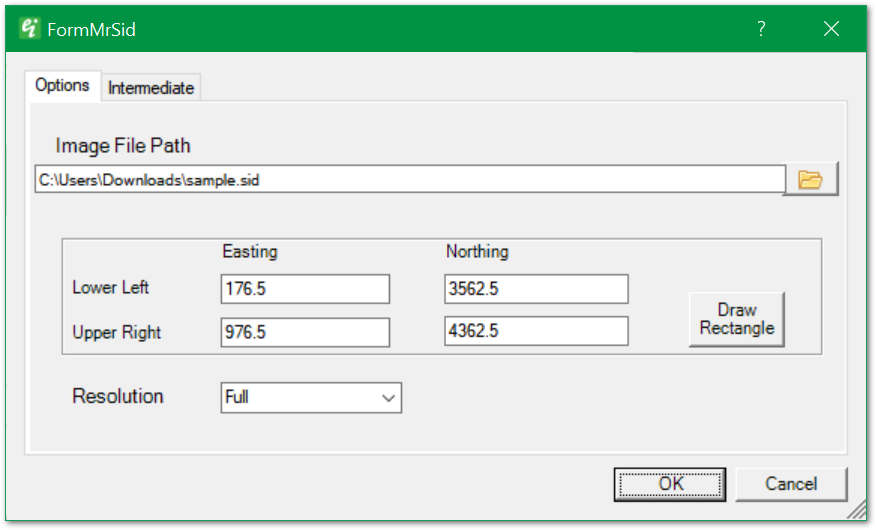
To insert a MrSID image, select Insert> Image from the main menu and select the image file from the browser. When a MrSID image is selected, the FormMrSID dialog box opens.
|
Image File Path: MrSID file path. Click the Browse button to browse to the MrSID file.
Coordinates (Lower Left/Upper Right & Easting/Northing): Coordinates of rectangular area to be drawn to the view. May be modified by editing these values or clicking the Draw Rectangle button.
Draw Rectangle: Click Draw Rectangle to redefine the bounds of the portion of the image to be represented in the view.
Resolution: Select from Full, Half, Quarter, or Eighth resolution for downsampling from the image's original resolution.
|
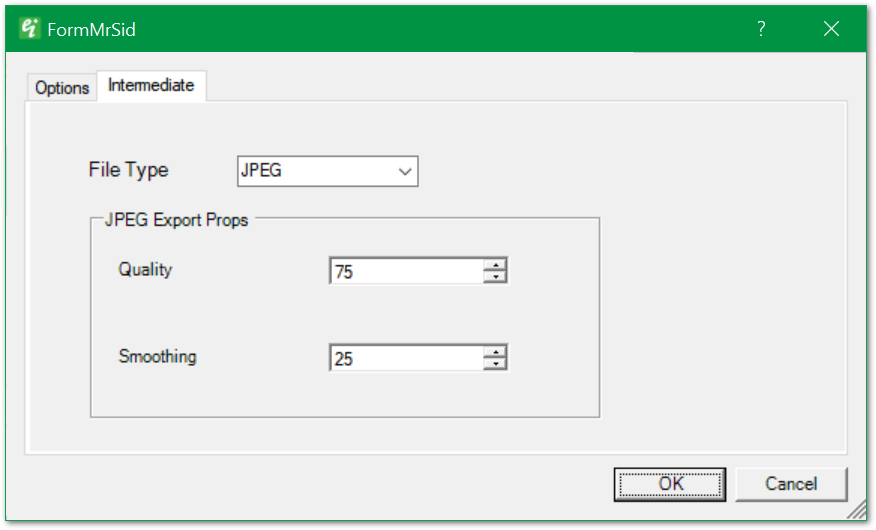
This dialog box allows for modification of the properties of the intermediate file created for insertion in EnviroInsite.
|
File Type: Select from JPEG, TIFF, BMP, or PNG as the output file type for the downscaled image that is inserted in the view.
JPEQ Export Props > Quality: Select the JPEG export Quality in percent.
JPEQ Export Props > Smoothing: Specify the smoothing factor in percent. Smoothing can reduce JPEG compression artifacts that occur by specification of lower quality images. |