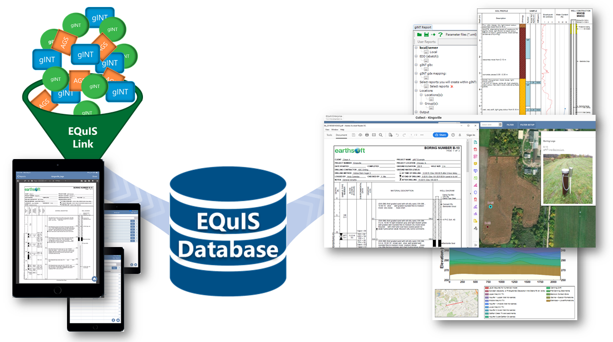
The Geotechnical Module solves challenges experienced by many geotechnical data professionals who want a single EQuIS Enterprise system that includes both environmental and geotechnical data in a consistent format, which facilitates analyzing and understanding the data.
A part of the solution is EQuIS Link, a powerful new data transformation tool that can easily migrate existing geotechnical data sources (e.g., gINT and AGS) with different data structures to EQuIS. Once geotechnical data are in EQuIS, users can easily generate boring logs and other graphics from ArcGIS Server, EQuIS EnviroInsite and EQuIS Enterprise. The Geotechnical Module in conjunction with EQuIS Collect (field data collection app) provides a complete geotechnical workflow allowing EQuIS clients to view logs in the field and the office as data are collected.