The Association of Geotechnical and Geoenvironmental Specialists (AGS) Data Format focuses on standardizing electronic data transfer related to engineering investigations, construction, and laboratory testing. The most recent update of the AGS Data Format (Version 4.1) includes an updated Data Dictionary and the addition of 24 Groups. EQuIS Link supports the AGS 4 format file. A standard AGS 4 Link mapping file (AGS 4 Link Mapping.link) is provided that maps a limited selection of the Groups included in AGS Version 4.1 to the EQuIS Geotechnical format. The AGS Groups mapped in the Link AGS 4 mapping file are listed below. If any other AGS Groups need to be mapped, please contact EarthSoft Support.
AGS Groups mapped to the EQuIS Geotechnical Format are:
•PROJ
•BKFL
•CDIA
•CMPT
•DETL
•GEOL
•GRAT
•HDIA
•HDPH
•HORN
•ISPT
•LLPL
•LNMC
•LOCA
•MONG
•MOND
•PIPE
•PTIM
•SAMP
•WSTD
•WTSG
•WADD
•CHIS
•IPID
•CORE
•FRAC
•IPEN
•IRES
The necessary support files for AGS version 4.1 are included in the EQuIS Professional package. To properly import the AGS Data Format Version 4.1 into EQuIS, the AGS Data Format file must follow the transfer file format rules outlined by AGS (https://www.ags.org.uk/) and follow the steps outlined below.
1.Open EDP.
2.Select Format in the Open group of the Home ribbon and open the Geotechnical format provided in the EQuIS Professional formats folder (e.g., C:\Program Files\EarthSoft\EQuIS\Formats\EarthSoft). Must be for EQuIS Build 7.21.2 or later.
3.Select the Link tab.
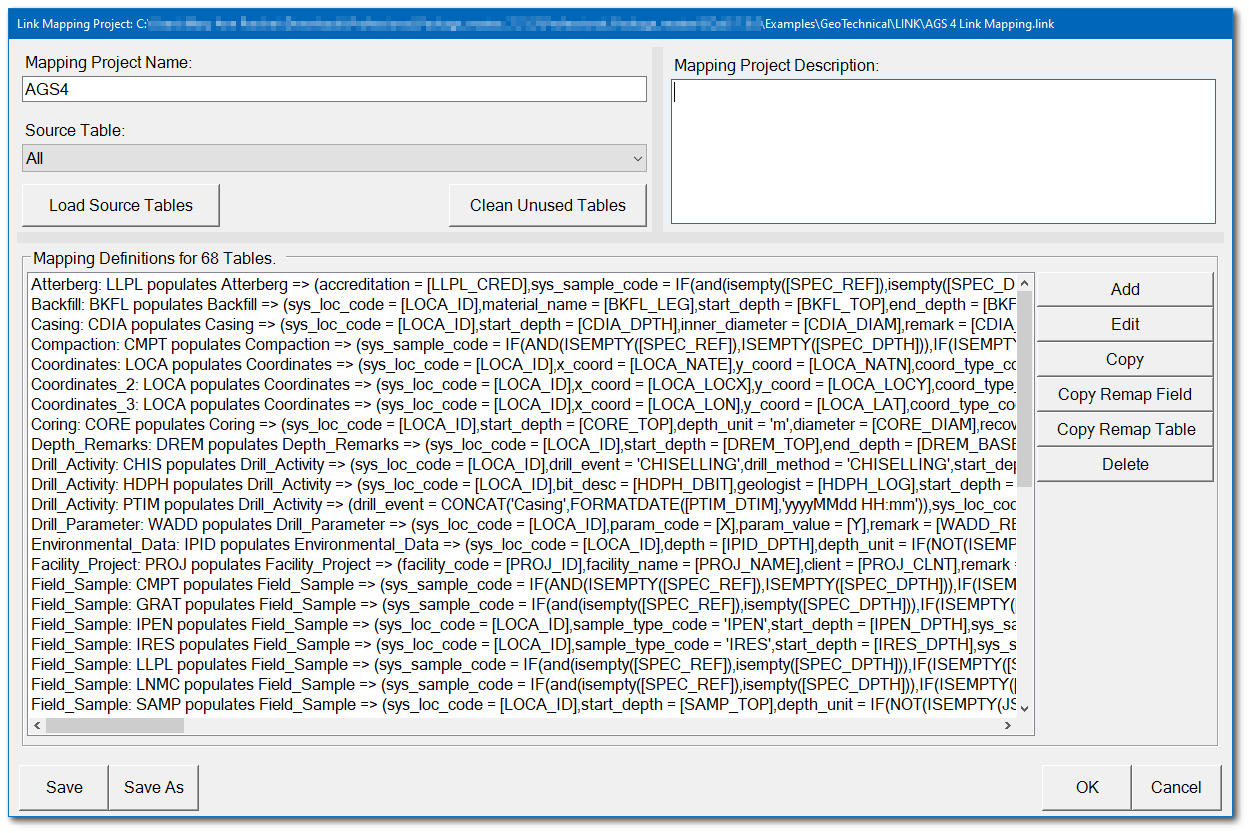
4.Select the Open button in the Project group of the Link ribbon and open the AGS 4 Link Mapping.link file included in the EQuIS Professional package for EQuIS Build 7.21.2 or later (in the Examples\Geotechnical\LINK folder).
5.The Mapping Project window opens displaying the data mappings associated with the AGS 4 project template. At this stage, the user is able to make edits to the mappings. After making edits (if needed), click the OK button.
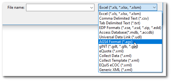
6.Select the Load button in the Project group of the Link ribbon and select the desired AGS 4 file to load into EQuIS. This may involve changing the file extension type to ".ags".
7.Data in the source file will be mapped to the format using the AGS 4 mapping project template. The Mapper Status dialog box details information on what EDD sections were successfully mapped, which sections were ignored, and if any errors were encountered. To copy the contents of the Mapper Status dialog box to the Windows clipboard, click the Copy button. The data mapping messages can be pasted from the clipboard to a desired file. Click the Done button to close the Mapper Status dialog box.
8.Resolve any errors encountered and then commit the data to the database.