|
<< Click to Display Table of Contents >> Navigation: EQuIS Library > Reports > EarthSoft Standard Reports > Water Level Reports > Water Levels II |
Report Name: Water Levels II (example)
File Name: EarthSoft.Reports.Library.64102.dll
Dependencies: N/A
Software: EQuIS Professional and EQuIS Enterprise
Source: EQuIS Professional install
Language: English
Output Type: Report Grid1
Description: The Water Levels II Report generates water level information. It is an improved Class Report version of the Water Levels (EQuIS func) Report. The Water Levels Report conveys information about water levels, LNAPLs, and DNAPLs stored in the DT_WATER_LEVEL table. This report uses specific logic for computing the corrected water level elevation, based on input parameters selected by the user. For more information, see Water Level Report Basics and the Water Level Elevation Correction Diagram.
Installation Instructions: This report assembly is part of the EQuIS Professional installation. No additional installation steps are necessary.
Overview:
The Location Name ("LOC_NAME" field) for this report is pulled from VW_LOCATION. Any location that does not have a correctly configured record in DT_COORDINATE (where DT_COORDINATE.COORD_TYPE_CODE = DT_FACILITY.COORD_TYPE_CODE and DT_COORDINATE.IDENTIFIER = DT_FACILITY.IDENTIFIER) will not be displayed. As a workaround, you can select the DT_LOCATION.LOC_NAME field as an "Additional Fields" parameter to display the Location Name from the DT_LOCATION table.
This report contains a hidden 'sigfigs' parameter that will allow configuration of the number of significant digits in the report output.
DT_WELL_SEGMENT of the Additional Fields drop-down list works with the default value of the SCREEN SEGMENT_TYPE. The value can be modified over ST_CONFIG by populating a new SEGMENT_TYPE value in STRING_VALUE of ST_CONFIG where CONFIG_SECTION=WL and CONFIG_KEY=SEGMENT_TYPE.
Tables: DT_WATER_LEVEL, DT_WELL, RT_ANALYTE_DETAIL, DT_LOCATION, RT_GROUP, RT_GROUP_MEMBER, DT_FACILITY, DT_MEASURE_DATUM, RT_UNIT, RT_UNIT_CONVERSION_FACTOR, VW_LOCATION.
Optional other tables, if Additional Fields are selected:
•DT_WELL
•DT_DRILL_ACTIVITY
•DT_FACILITY
•DT_LOCATION
•DT_MEASURE_DATUM
•DT_TASK
•DT_WATER_LEVEL
•VW_LOCATION
•DT_WELL
•DT_WELL_SEGMENT
Report Parameters |
||||||||||||||||||||
|---|---|---|---|---|---|---|---|---|---|---|---|---|---|---|---|---|---|---|---|---|
|
||||||||||||||||||||
* This report includes hidden parameter: ebatch, Water level Approval Code(s), sigfigs (defaults to 6), Water Level Default Specific Gravity (defaults to 0.8).
** The Extra Selects or @extra_select is a hidden parameter available for advanced users to configure in ST_REPORT_PARAMETER and allows for supplementing report output using the fields available in the Additional Fields parameter. Please see additional documentation regarding Extra Selects here. |
Report Output |
||
|---|---|---|
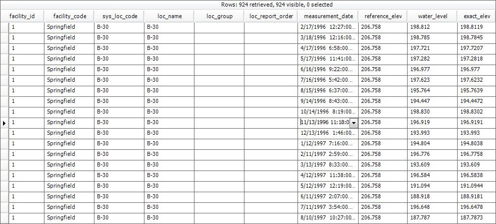
FACILITY_ID FACILITY_CODE SYS_LOC_CODE LOC_NAME LOC_GROUP LOC_REPORT_ORDER MEASUREMENT_DATE REFERENCE_ELEV WATER_LEVEL EXACT_ELEV MEASURED_DEPTH_OF_WELL DEPTH_UNIT |
BATCH_NUMBER TECHNICIAN DRY_INDICATOR_YN MEASUREMENT_METHOD DIP_OR_ELEVATION REMARK EQUIPMENT_CODE LNAPL_CAS_RN LNAPL_DEPTH LNAPL_THICKNESS LNAPL_DENSITY |
WATER_DEPTH WATER_LEVEL_DEPTH DNAPL_CAS_RN DNAPL_DEPTH DNAPL_THICKNESS TASK_CODE APPROVAL_CODE X_COORD Y_COORD LONGITUDE LATITUDE |
1The Report Grid provides additional export options to Excel, Google Earth, Outlook, Shapefile, PDF, Text, Access, XML, or a printer.
Copyright © 2023 EarthSoft, Inc • Modified: 25 Nov 2021