|
The Select Locations tool can be used to select locations from the EQuIS Facility Locations Points layer. To use this tool, first add a facility location layer to your map. Then, clicking the Select Locations button from the ArcEQuIS toolbar will open the Locations tab within the ArcEQuIS Graphics Panel. |

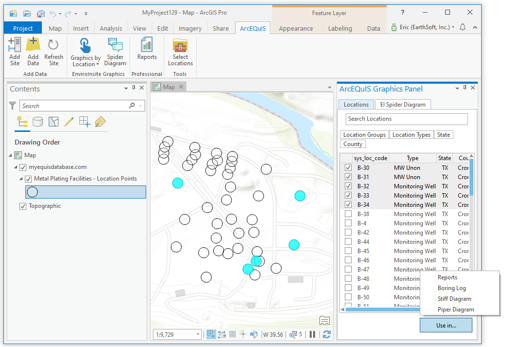
Use this tab to select points for use in EQuIS graphics and reports by following these steps:
1.Select locations by using any of ArcGIS Pro’s built-in selection tools, such as the Select tool for selecting points on the map, or the Select by Attributes or Select by Locations tools.
2.Individual locations can be selected using the check box next to the point’s name. The list of locations can be filtered by clicking any of the four properties listed at the top of the Locations tab:
oLocation Groups
oLocation Types
oState
oCounty
3.Click the ‘Use in...’ button, as pictured in the screenshot above.
4.Select one of the options: Reports, Boring Log, Stiff Diagram or Piper Diagram.
Note: The prerequisites listed on the Graphics by Location page are required for generating Boring Log, Stiff Diagram and Piper Diagram layers. |
|---|