Click Plot > 3D Data from the main menu and select Locations. The Locations dialog box opens. Modify the properties of the locations plot on the following tabs as desired:
•Query Tab |
•Format Tab •EQuIS Locations Group Tab |
Where not covered below, location layer options are described on the 2D Locations page.
Click the OK button to save changes.
|
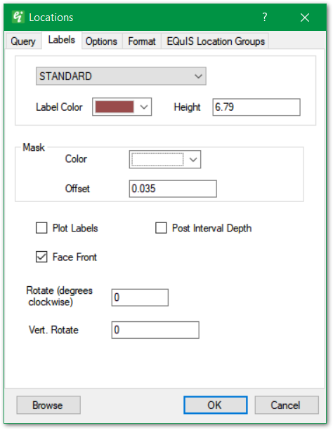
Use the top dropdown to select the Label Text Style. Text styles are defined as document properties.
Label Color: Select the label color.
Height: Enter text height in real-world coordinates.
Mask: The label's background mask is a font outline to enhance the visibility of text drawn over busy background images.
Mask > Color: Select background mask color.
Mask > Offset: Specify the mask width, expressed as a fraction of the specified text height.
Plot Labels: Check to plot Location ID labels.
Rotate (degrees clockwise): Set the label rotation in degrees clockwise.
Vert. Rotate: Set the Vertical rotation in degrees. |
|
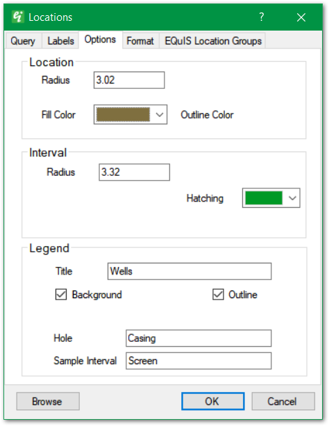
Location > Radius: Set location symbol radius in real-world length units.
Location > Symbol: Use this dropdown in the top right to select the location symbol style.
Location > Fill Color & Outline Color: Select the location symbol fill and outline colors.
Interval > Radius: Set the draw radius for the interval section.
Interval > Hatching: Set the hatching color used in the interval horizon.
Legend > Title: Enter legend title.
Legend > Background: Check to draw legend background.
Legend > Outline: Check to draw legend outline.
Legend > Hole & Sample Interval: Set descriptive terms used in legend (only used in 2D and 3D location plots). |